|
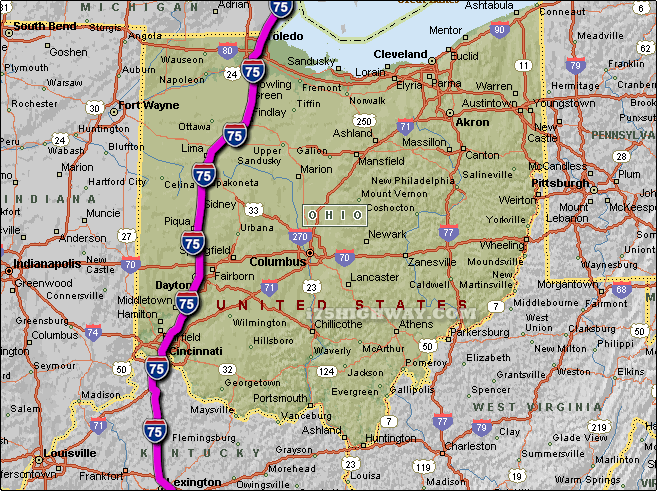
The i-75 travels across Ohio in generally a north - south direction
... to the north; the i-75 travels into the state of
Michigan,
and to the south; the i-75
travels into the state of Kentucky.
The total distance of the i-75 across the state of Ohio is approx. 211 miles
long, which requires an approx. driving time of 3 hours and 31 minutes to complete when driving an average speed of 60 miles
per hour.
See also: Regional i-75 Ohio traffic maps;
Arlington Heights,
Beaverdam,
Bluffton,
Bowling Green,
Centerville,
Cincinnati,
Dayton,
Elmwood Place,
Evendale,
Findlay,
Franklin,
Glendale,
Kettering,
Lima,
Lincoln Heights,
Lockland,
Mason,
Miamisburg,
Middletown,
Perrysburg,
Piqua,
Reading,
Sharonville,
Sidney,
St. Bernard,
Tipp City,
Toledo,
Troy,
Vandalia,
Wapakoneta,
Wetherington,
and
Woodlawn.
SEE ALSO:
i-75 Ohio Traffic Map. |