|
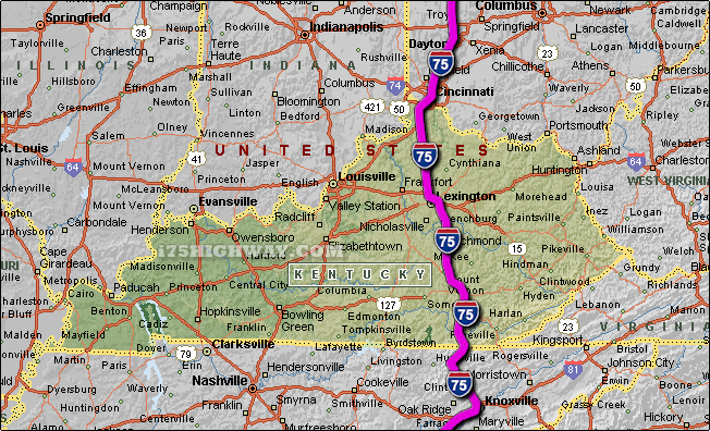
The i-75 travels across Kentucky in generally a north - south direction
... to the north; the i-75 travels into the state of
Ohio,
and to the south; the i-75
travels into the state of Tennessee.
The total distance of the i-75 across the state of Kentucky is approx. 192
miles long, which requires an approx. driving time of 3 hours and 12 minutes to complete when driving an average speed of 60 miles
per hour.
See also: Regional i-75 Kentucky traffic maps;
Berea,
Corbin,
Covington,
Crescent Park,
Crescent
Springs,
Crittenden,
Dry Ridge,
Erlanger,
Florence,
Fort Mitchell,
Fort Wright,
Georgetown,
Lake City,
Lexington,
London,
Richmond,
Walton, and
Williamsburg.
SEE ALSO:
i-75 Kentucky Traffic. |