|
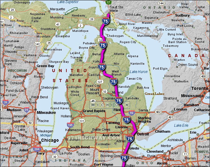
The i-75 travels across Michigan in generally a north - south direction... at
it's northern most point, the i-75 begins/ends at the Canada - US border on the
International Bridge located between the cities of Sault Ste Marie Ontario and
Sault Ste Marie Michigan ...
travelling south on the i-75 across Michigan; the i-75 travels into the state of
Ohio.
The total distance of the i-75
across the state of Michigan is approx. 396 miles long, which requires an
approx. driving time of 6 hours and 36 minutes to complete when driving an average speed of 60 miles
per hour.
See also: Regional i-75 Michigan traffic maps;
Auburn Hills,
Bay City,
Birch Run,
Bridgeport,
Buena Vista,
Detroit,
Flint,
Gaylord,
Grayling,
Indian River,
Lincoln Park,
Mackinaw City,
Madison
Heights,
Monroe,
Pontiac,
Rockwood,
Royal Oak,
Saginaw,
Sault Ste.
Marie,
Southgate,
St. Ignace,
Troy,
Vanderbilt,
Vienna,
Wolverine,
Woodhaven,
and Zilwaukee.
SEE ALSO:
i-75 Michigan Traffic Map. |