|
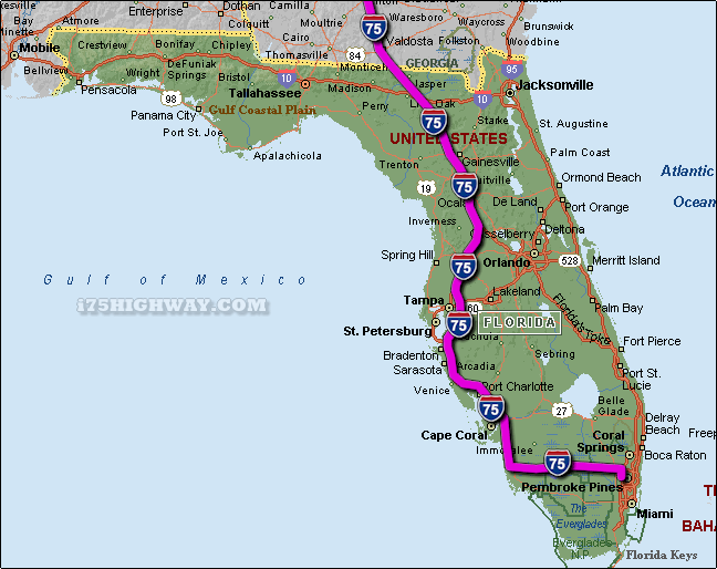
The i-75 travels across Florida in generally a north - south direction ... at
it's southern most point, the i-75 begins/ends near the southeast corner of
mainland Florida in the Hialeah - Miami Lakes area of Metro Miami ... travelling
north on the i-75 across Florida; the i-75 travels into the state of
Georgia.
The total distance of the i-75 across the state of Florida is approx. 471
miles long, which requires an approx. driving time of 7 hours and 51 minutes to complete when driving an average speed of 60 miles
per hour.
SEE ALSO:
i-75 Florida Traffic Map.
|